Draw Single Leg Route

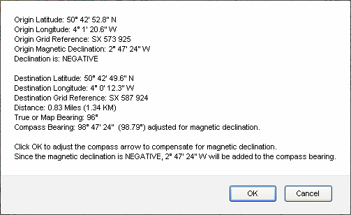
Clicking on the 'Draw Route' button at the upper right of the map will display a wide range of route information:

Clicking 'OK' on the display will adjust the red compass direction of travel arrow to compensate for magnetic declination.
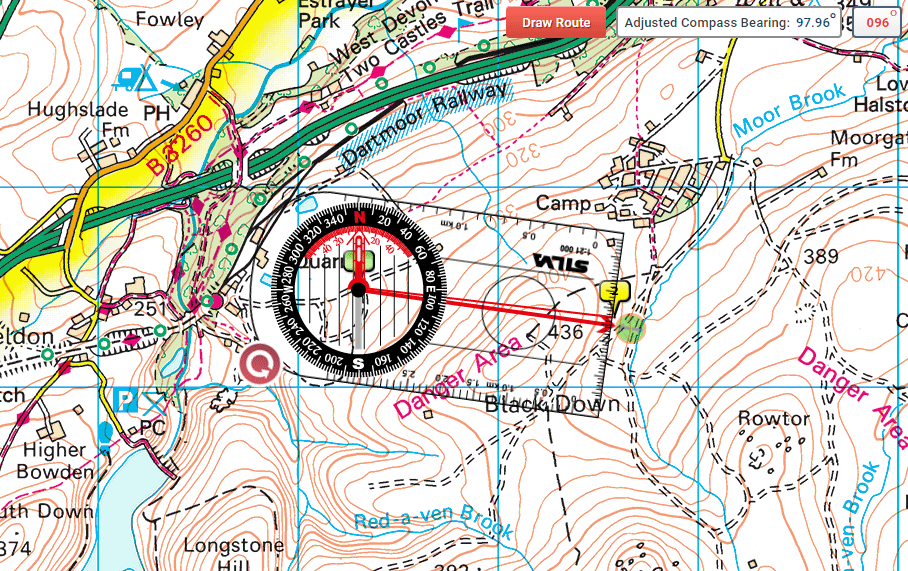
The compass bearing display adjusted for magnetic declination (97.96º in the example below) will appear in the lower right corner. This is the bearing you set on your compass to navigate from Marker 1 (green) to Marker 2 (yellow).
The map or true bearing display appears in the upper right corner (96º in this example).
Clicking 'Cancel' on the route information display will leave the red direction of travel arrow unadjusted, and no compass bearing display will appear in the lower right corner.
Once you have finished, you can hide the compass, save and print your route.
The map cannot be moved if the compass is showing. In this case, click the 'Hide Compass' button, move the map to the required position, then click 'Show Compass' which will return the compass to its last position.

Ordnance Survey Compass route information
Clicking 'OK' on the display will adjust the red compass direction of travel arrow to compensate for magnetic declination.
The compass bearing display adjusted for magnetic declination (97.96º in the example below) will appear in the lower right corner. This is the bearing you set on your compass to navigate from Marker 1 (green) to Marker 2 (yellow).
The map or true bearing display appears in the upper right corner (96º in this example).
Clicking 'Cancel' on the route information display will leave the red direction of travel arrow unadjusted, and no compass bearing display will appear in the lower right corner.
Once you have finished, you can hide the compass, save and print your route.

Ordnance Survey Compass single leg route
The map cannot be moved if the compass is showing. In this case, click the 'Hide Compass' button, move the map to the required position, then click 'Show Compass' which will return the compass to its last position.